
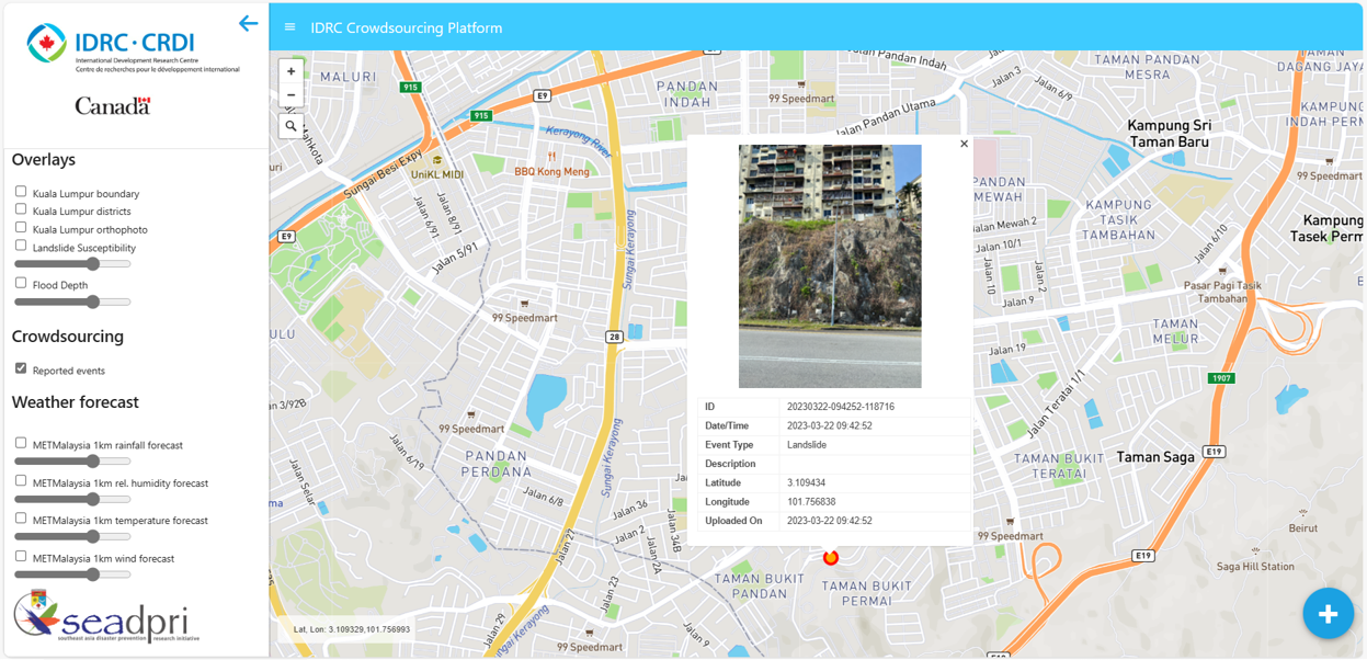
Hazard Specific Susceptibility Maps
Maps have been developed for areas susceptible to sea level rise, floods and landslides in Selangor, and drought in Cambodia. They were used in student thesis, publications and other research products. In Selangor, information from the MyBahaya Platform will be used to improve the hazard susceptibility maps.